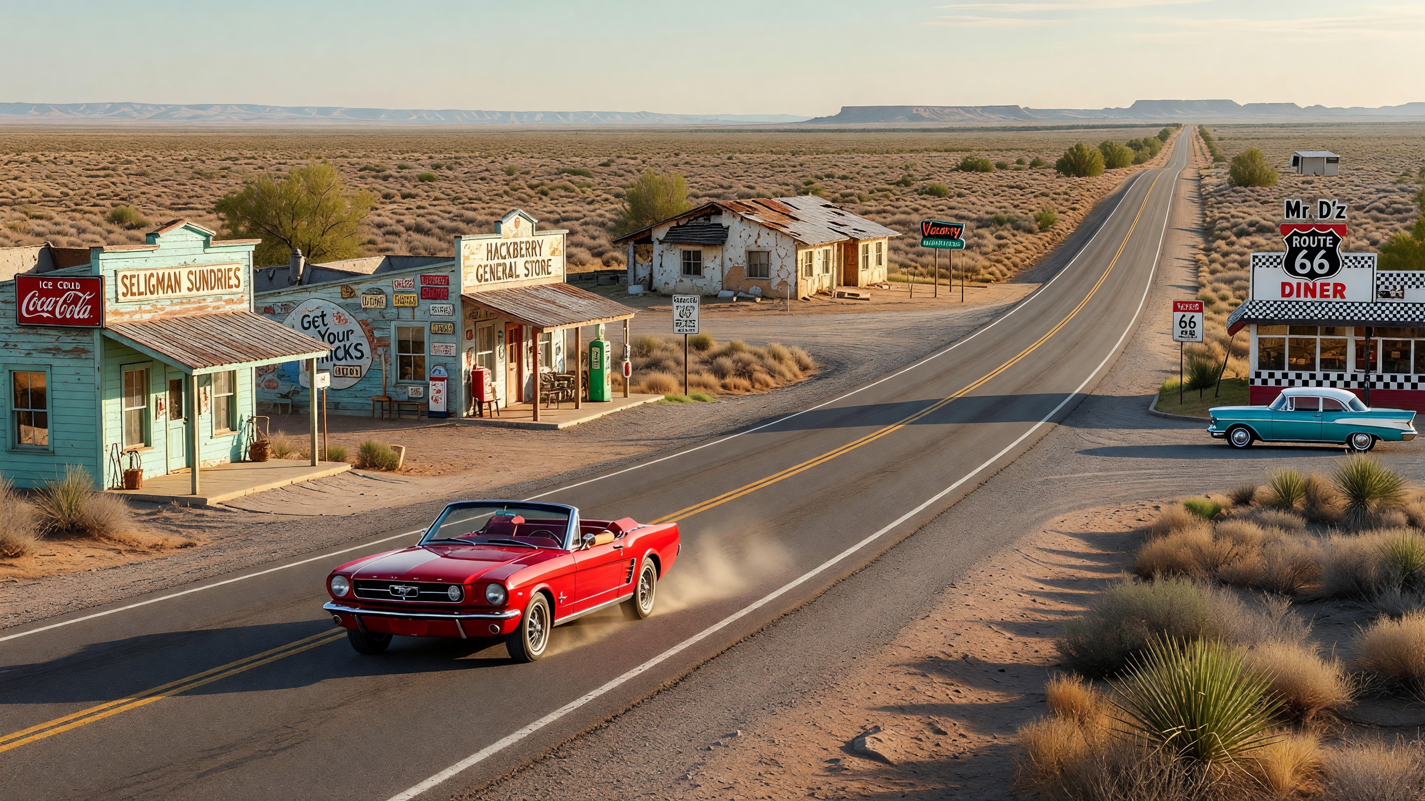
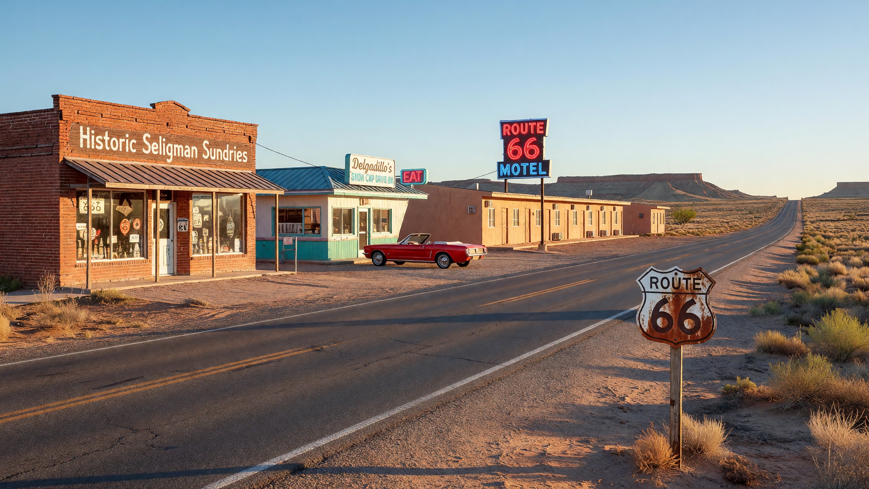
The Arizona stretch of Route 66 between Seligman and Kingman is often described as the longest uninterrupted segment of the old highway still in use — roughly 90 miles of two-lane road that bypassed the Interstate’s attention long enough to survive with much of its mid-century character intact. What that character includes, for the traveler willing to look carefully, is a series of communities in various stages of abandonment and survival: places that were diminished nearly to nothing by the Interstate’s bypass and have since found various states of equilibrium between ghost town and working community.
These are not ghost towns in the mining-camp sense — deserted overnight, frozen in time. They are slower disappearances, communities that contracted gradually as the commercial rationale for their existence evaporated, leaving behind buildings, artifacts, and occasionally a few determined residents.
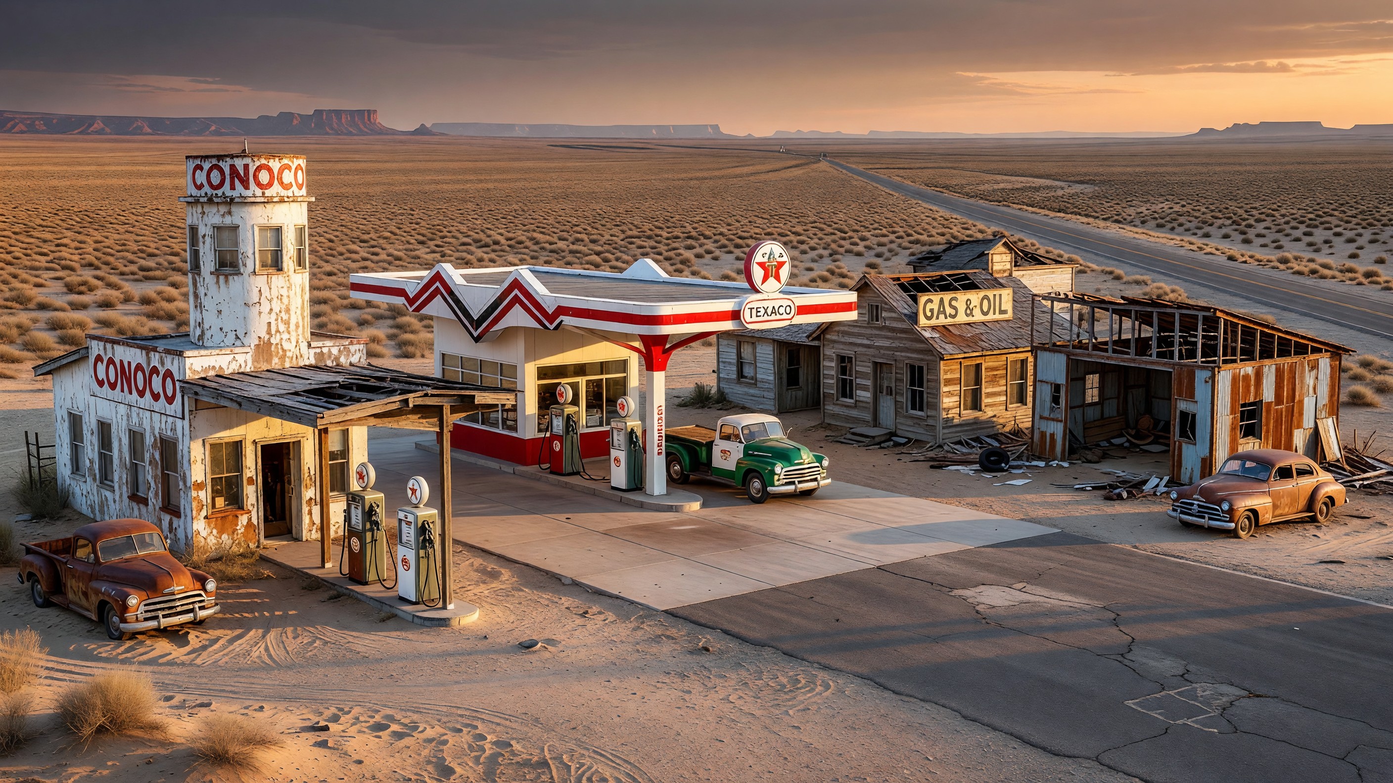
Hackberry: The Conoco Station That Became a Museum
Hackberry sits on Route 66 roughly 20 miles northeast of Kingman. Before Interstate 40 bypassed it, it was a functioning community on the highway — a gas station, a school, a handful of residences scattered in the high desert. The Hackberry General Store (formerly a Conoco station) is the reason people stop here now.
The store operates as a combination gift shop, Route 66 museum, and roadside attraction. Its exterior is covered in an accumulating inventory of vintage automotive artifacts — old pumps, car parts, signage, a 1957 Corvette that sits in front as an ongoing photo backdrop. Inside, the original station character survives under layers of Route 66 merchandise and memorabilia.
The building has been documented as one of the more photographed sites on the entire Arizona Route 66 corridor, a reputation it has built partly on the quality of the artifact collection and partly on the owners’ commitment to maintaining its visual appeal. It is a genuine stop — not just a photo opportunity — for travelers who want to understand what highway commerce looked like before the Interstate.
Hackberry as a community beyond the store is sparse. A few occupied houses, the school building gone, the infrastructure of a functioning town present in outline rather than reality. It reads clearly as a place whose commercial purpose departed with the traffic.
Truxton: The Crossroads That Remains
Truxton (sometimes spelled Truxton Canyon on older maps) sits roughly at the midpoint of the Seligman-to-Kingman corridor, at an elevation where the pinyon and juniper of the high desert begin to thin. It has a small inhabited core — a few year-round residents, the remains of a motel operation, and the Frontier Café and Motel, which has operated in various states of activity for decades.
The Frontier is worth knowing about specifically because it represents a type of Route 66 business that is increasingly rare: a genuine local commercial operation, not a Route 66 attraction or a nostalgia-driven tourism project, but a working motel and diner that has operated because people in this part of the world need such things. Its future is uncertain in the way that all remote rural businesses are uncertain.
The history of Truxton illustrates a dynamic common to Route 66 bypass communities: the immediate post-bypass collapse of traveler-dependent businesses, followed by a second phase of attrition as local population declined (fewer local customers), followed in some cases by stabilization at whatever level of activity the remaining local population could sustain.
Peach Springs: The Hualapai Capital
Peach Springs is the administrative center of the Hualapai Tribe’s reservation, which encompasses a significant stretch of land south of Route 66 including Hualapai-controlled sections of the Grand Canyon’s south rim. It is not a ghost town — it has a functional government, a tribal headquarters, and a community that predates Route 66 by generations.
What Peach Springs represents along the Route 66 corridor is something more complex than simple bypass abandonment. The community’s commercial activity (including the Hualapai’s Grand Canyon West operation, about 50 miles south via a tribal road) has provided an economic base that is not dependent on Route 66 through traffic in the way that Hackberry or Truxton were. The town remains alive because it serves a function independent of the highway.
This distinction matters for Route 66 travelers: Peach Springs is a real community, not a relic. The Diamond Creek Road through the reservation provides the only vehicle access to the Colorado River within Grand Canyon (at the bottom of Diamond Creek) that does not require a multi-day river trip. A permit from the Hualapai Nation is required for this access. The tribal office handles permits for day use and camping.
Nelson: The Abandoned
Between Kingman and the California border, the Route 66 corridor has sections that have simply ceased to exist as anything but pavement through empty desert. Nelson, formerly called Yucca (the post office designation changed at some point, creating confusion in historical records), exemplifies the category of complete abandonment.
The location had a small collection of buildings at the highway junction — the kind of assemblage that appears in old highway photographs as evidence that someone once needed a reason to stop here. What that reason was — water for radiators, a rest stop, mechanical service for the desert crossing — is less clear than the fact of the buildings’ presence. Today the location is marked by GPS coordinates more than by any visible commercial remnant. The land itself is unchanged from the 1930s; the human infrastructure has simply returned to desert.
The Experience of Driving Through
The emotional effect of driving this corridor — from Seligman through Hackberry to Kingman, with the ghost towns at intervals — is partly historical and partly about the landscape itself. The high desert at this elevation (roughly 3,500-5,500 feet) is a specific kind of beautiful: wide sky, flat-to-rolling terrain with mesa outcroppings, the Santa Fe Railway tracks running parallel to the road for much of the distance.
The ghost towns and near-ghost towns exist within this landscape in a way that feels continuous with it rather than imposed on it. The buildings that remain — even the photogenic ruins that Route 66 travelers document obsessively — are made of adobe, cinder block, and corrugated metal that weather toward the color of the desert rather than against it.
For the practical details of driving this stretch, including what to expect at each stop and how to time the drive, see our complete guide to the Route 66 corridor from Seligman to Kingman.
Frequently Asked Questions
Is it legal to explore Route 66 ghost town buildings?
Most standing structures along the Route 66 corridor are on private land. Entering private property without permission is trespassing regardless of the building’s condition or apparent abandonment. The Hackberry General Store and other active operations welcome visitors; vacant buildings beside the highway are typically private property. Photograph from the road; do not enter structures.
Are the Route 66 ghost towns safe to visit?
Driving the Route 66 corridor through these communities is safe and straightforward. The road is maintained and paved. The hazards of the stretch are what you would expect on a remote two-lane desert highway: limited services (fuel up in Seligman or Kingman, not between), variable cell coverage, and summer heat. Visit with a full tank, water for the drive, and offline maps.
What is the best ghost town to visit on Arizona’s Route 66?
The Hackberry General Store is the most developed destination among the abandoned-community sites — it offers an actual visitor experience within a structure that preserves the spirit of the original station. For a more complete sense of bypass abandonment without active tourism infrastructure, the communities between Truxton and Hackberry provide a clearer picture.
How long does it take to drive Route 66 from Seligman to Kingman?
Without stops, the 90-mile drive takes about 1.5 to 2 hours on the two-lane. With stops at Hackberry, Truxton, and the other points of interest, a half-day is appropriate. Driving east-to-west (Seligman toward Kingman) puts the afternoon sun behind you, which is worth considering for photography.
Further Reading from Authoritative Sources
- National Park Service — Route 66 Corridor — NPS documentation of the Route 66 corridor including the Arizona segment, with historical context on community development and decline.
- Smithsonian Magazine — Route 66 and American Migration — Historical overview of Route 66’s role in American migration, economic development, and the communities the highway created and destroyed.