Route 66 from Chicago to Los Angeles is 2,448 miles of original alignment — though “original” is a complicated word for a road that was continuously rerouted, realigned, and abandoned in sections from its 1926 commissioning through its official decommissioning in 1985. What you drive today is a combination of original alignment, successor alignments, county roads maintained locally, and Interstate segments where the old road simply doesn’t exist anymore.
Understanding this before you go prevents the frustration of expecting a continuous historic highway and finding instead a patchwork that requires navigation, local knowledge, and a tolerance for pavement that ranges from excellent to genuinely rough.
This guide covers the full trip realistically: what to expect, where to invest time, and how much of it you can actually drive.
The Realistic Timeline
A minimum of ten days is required to drive the corridor without rushing and missing the most significant stops. Two weeks is the appropriate allocation for a trip that includes the experiences worth having along the way. A week is possible but produces a driving-focused experience with limited time to actually explore the places that matter.
The breakdown by state, in driving days:
- Illinois (1 day): Chicago start to St. Louis area. The Illinois segment has good surviving alignment and worthwhile stops in Springfield (Cozy Dog Drive-In, Abraham Lincoln sites).
- Missouri (1.5 days): Meramec Caverns, the Wagon Wheel Motel in Cuba, Springfield.
- Kansas (0.5 day): The shortest Route 66 state — only 13.2 miles. The segment through Galena and Riverton is worth the detour from Missouri into Oklahoma.
- Oklahoma (1.5 days): The Blue Whale of Catoosa, Tulsa (restored Brady Arts District), Arcadia Round Barn, Oklahoma City area.
- Texas (1 day): Amarillo, the Cadillac Ranch, McLean, the Tower Station at Shamrock.
- New Mexico (1.5 days): Tucumcari (Blue Swallow Motel, multiple neon survivors), Santa Fe spur, Albuquerque, Gallup.
- Arizona (2 days): This is where the most intact stretch of Route 66 exists. Seligman, the Seligman-to-Kingman corridor, Williams, Flagstaff, Winslow.
- California (1-1.5 days): Needles, Barstow, San Bernardino, the end of the road on Santa Monica Pier.
Chicago: Starting at the Source
The official start of Route 66 is at the intersection of Michigan Avenue and Adams Street in Chicago — today marked by a street sign that is itself a destination for Route 66 travelers. The Grant Park area and the Chicago waterfront make for a compelling departure point.
The Illinois segment heads south through Chicago’s south side neighborhoods, through historic commercial strips in Harvey and Joliet where surviving roadside architecture from the 1930s-1950s still stands in varying states of preservation and decay. This section requires patience — it is urban street driving, not open highway — but the architectural density repays close attention.
Springfield, Illinois provides the best rest stop in the state: the Cozy Dog Drive-In (creator of the food that became the corn dog in its current form), the Lincoln Home and Presidential Library, and a commercial strip on West Sixth Street with genuine midcentury survivors.
The Critical Oklahoma Section
Oklahoma has invested more consistently than any other Route 66 state in preserving and documenting its highway heritage. The result is a state where the old alignment is well-marked, the historic properties are reasonably accessible, and the local knowledge is available.
The stretch between Miami and Tulsa contains some of the most intact early highway commercial architecture on the entire corridor. The Waylan’s Ku-Ku Burger in Miami, the Brush Creek Bridge in Afton, and the Oklahoma Route 66 Museum in Clinton are all worth specific stops. Tulsa’s Brady Arts District has undergone significant preservation and redevelopment with Route 66 heritage as a central theme.
The Oklahoma segment also contains the Totem Pole Park near Foyil — a privately created outsider art installation that dates to the 1940s and is one of the genuinely unusual stops on the full corridor.
The Texas Panhandle: Wide and Flat
Texas contributes 186 miles to Route 66, mostly across the Llano Estacado — the flat, semi-arid high plains that stretches from Shamrock in the east to the New Mexico border. The driving is easy and the landscape is relentless in a way that either appeals to you or doesn’t.
Amarillo is the major stop: the Big Texan Steak Ranch (the 72-ounce steak challenge), and critically, Cadillac Ranch — a 1974 art installation by the Ant Farm collective in which ten Cadillacs, from 1949 to 1963, are buried nose-first at an angle matching the Great Pyramid’s pitch. The installation is on private land but open to public access and has been a Route 66 landmark for fifty years. Visitors are encouraged to add spray paint to the accumulated layers; bring a can.
The Tower Station and U-Drop Inn in Shamrock, near the Oklahoma border, is one of the finest examples of Art Deco highway commercial architecture surviving in any state.
New Mexico: Neon and High Desert
Tucumcari is the quintessential Route 66 neon town — the Blue Swallow Motel’s original neon sign, the Tee Pee Curios sign, and multiple surviving motel signs from the highway’s peak era are best experienced at dusk when the neon actually illuminates. Booking a room at the Blue Swallow Motel puts you in a 1939 property where the neon is genuine and the motel courts are intact.
Albuquerque’s Route 66 alignment runs through Central Avenue — the original highway alignment through the city — which retains significant historic commercial character alongside more recent development. The Pueblo Deco architecture in Albuquerque represents a regional vernacular version of the Art Deco style that is worth understanding as you drive through.
Gallup, at New Mexico’s western edge, is the last major town before the Arizona line and has its own collection of historic motels and commercial buildings that reflect the town’s position as a long-standing rest stop on the western corridor.
Arizona: The Most Intact Corridor
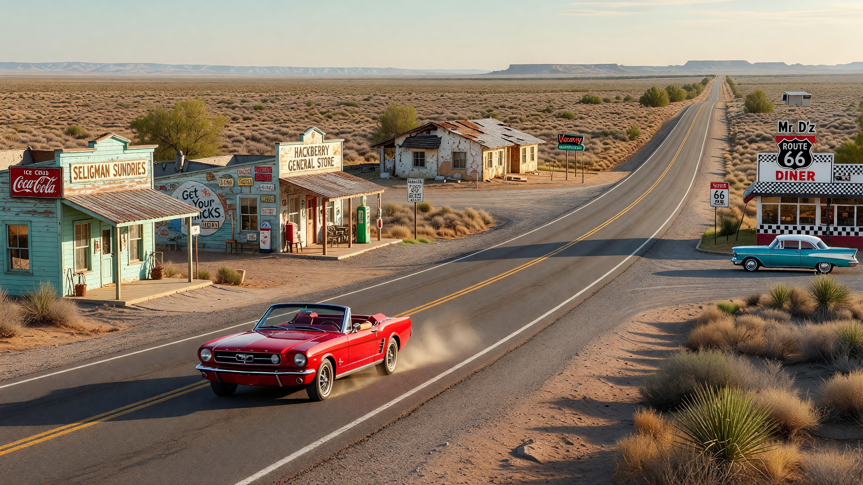
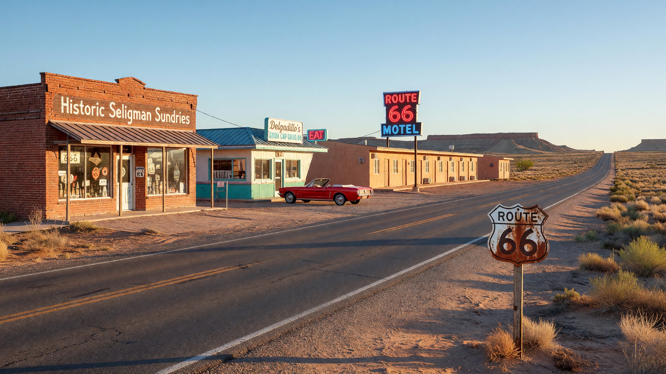
The Arizona segment is why many Route 66 travelers consider the western third of the trip the most rewarding. The combination of dramatic landscape, intact historic communities, and the preservation movement that began in Seligman in 1987 has produced a section of the old highway that feels most continuous with what Route 66 was.
Seligman is the essential Arizona stop — the birthplace of the Route 66 preservation movement, the model for Pixar’s Cars, and the eastern gateway to the most intact stretch of the old road. The Seligman-to-Kingman corridor through Hackberry and Truxton is 90 miles of two-lane highway with no Interstate alternative for this stretch.
Williams is a worthwhile stop for its walkable commercial district and its position as the gateway town for the South Rim of the Grand Canyon — a side trip that most Route 66 travelers incorporate at this point.
Flagstaff is the largest city on the Arizona corridor — a university town with a lively downtown on the historic alignment and access to Monument Valley, Walnut Canyon, and Sunset Crater for side excursions.
California: The Final Descent
The California segment covers Needles (gateway from Arizona, extreme heat in summer), Barstow (Route 66 Mother Road Museum at the Casa del Desierto Harvey House), the Inland Empire, and the final run into Los Angeles via San Bernardino and a series of civic boulevards.
The Santa Monica Pier is the conventional endpoint — Will Rogers Highway sign at the pier, ocean air, the Pacific horizon. After driving through Oklahoma’s plains and Arizona’s desert, the Pacific has a legitimately moving quality.
Frequently Asked Questions
How long does it take to drive Route 66 from Chicago to Los Angeles?
Ten to fourteen days is the appropriate allocation for a complete drive with meaningful stops. A minimum of ten days allows the key stops in each state without constant rushing. Two weeks provides enough time to explore destinations in depth and make spontaneous stops. A week is possible but produces a driving-focused trip with limited time for the experiences that make the route worthwhile.
Do you need a guide or map for driving Route 66?
The EZ66 Guide by Jerry McClanahan is the most consistently recommended navigation resource for the complete drive — it is designed for the road, not for looking at on a screen, and covers route-finding in sections where the alignment is unclear or interrupted. Download the official Route 66 app as a supplement; offline maps are essential for the remote Arizona and New Mexico sections.
What is the best time of year to drive Route 66?
Spring (April-May) and fall (September-October) are the optimal seasons. Summer is possible but requires extra preparation for heat in Texas, New Mexico, and California desert sections — and is brutally hot in the Mojave. Winter driving is feasible in most segments but December through February can produce ice and snow in the New Mexico and northern Arizona highlands.
What is the most scenic section of Route 66?
The Arizona segment between Seligman and Kingman is consistently cited as the most dramatic — high desert, mesa country, the historic corridor with minimal modern intrusion. The New Mexico segment near Albuquerque and the Oklahoma segment through the Ozarks are also frequently cited.
Further Reading from Authoritative Sources
- National Park Service — Route 66 Planning Guide — The NPS official planning guide for driving Route 66, including state-by-state alignment guidance and historic property information.
- Route 66 Association — Member Resources — The Historic Route 66 Association of Arizona, founded in Seligman in 1987, provides current conditions and visitor information for the Arizona segment.